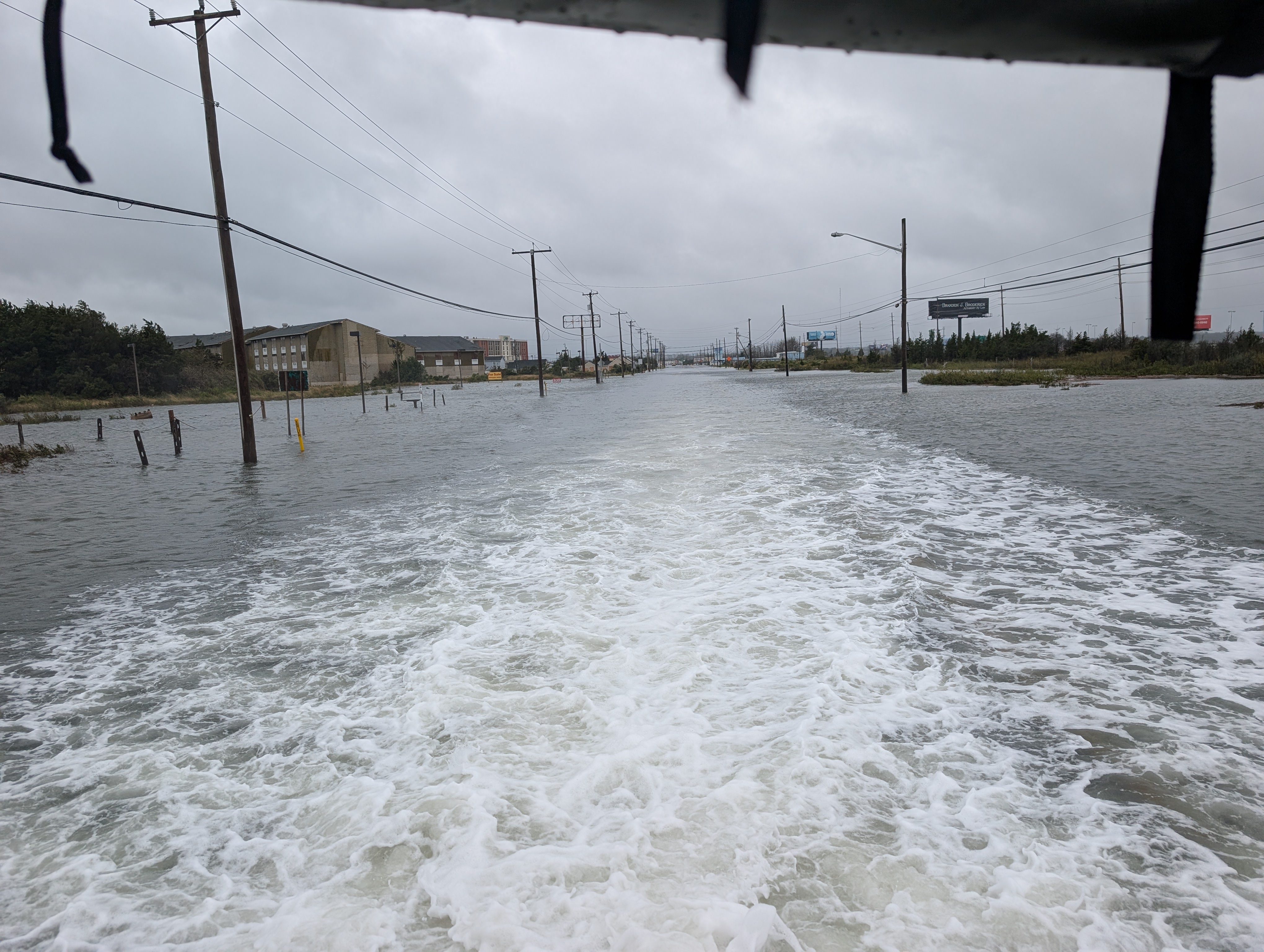
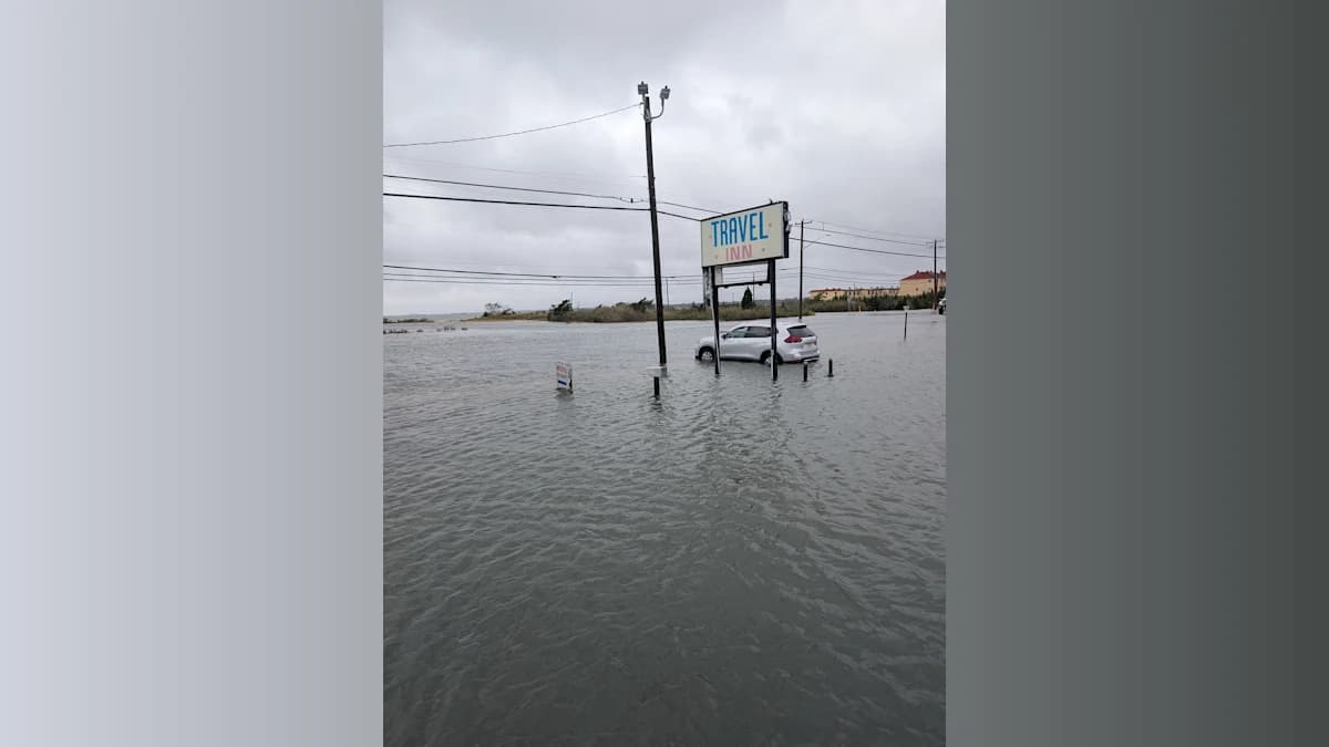
EGG HARBOR TOWNSHIP — Firefighters rescued nine people and a dog from flooded motel rooms in West Atlantic City on Saturday morning after a powerful nor'easter drove tidal water two to three feet deep into first-floor rooms.
One of those rescued used a wheelchair.
And after getting the motel guests to safety, firefighters returned to check the flooded rooms — and discovered a fire.
The dramatic response unfolded shortly after 9 a.m. Saturday at the Travel Inn and New Sea Breeze motels in the West Atlantic City section of Egg Harbor Township, according to a release from township officials.
The Pleasantville Fire Department initially responded to check on the welfare of motel guests as tidal flooding inundated the low-lying area.
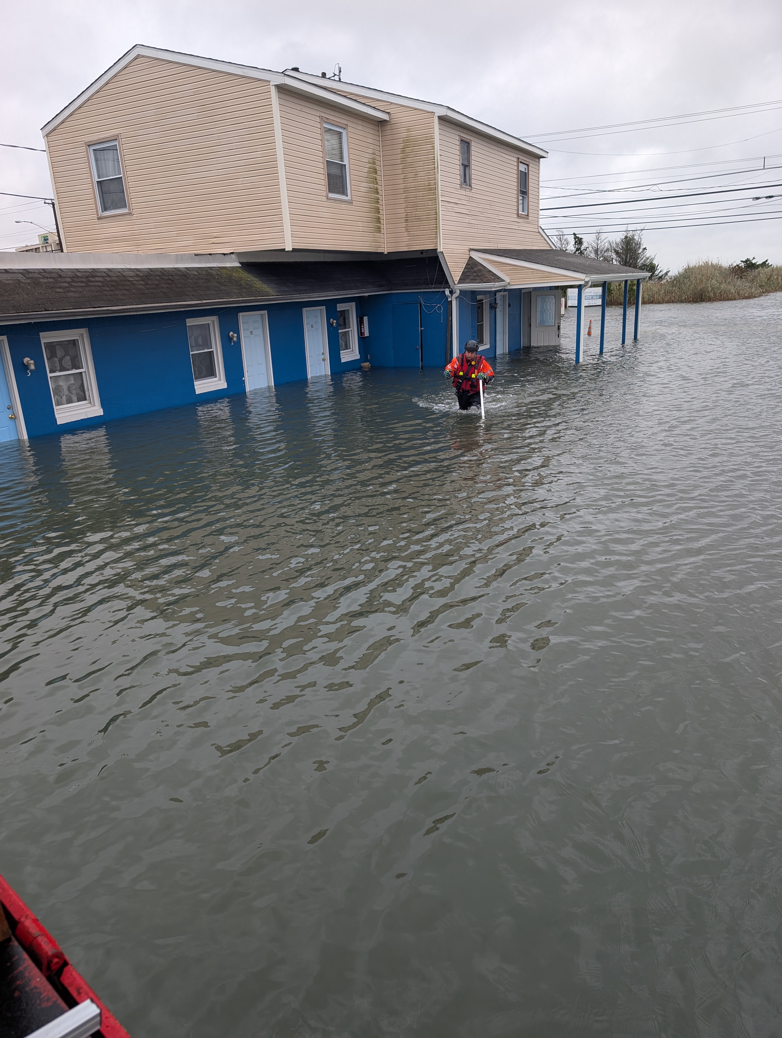
Officials said water had risen two to three feet inside first-floor motel rooms.
The Bargaintown Volunteer Fire Company subsequently responded with its high-water rescue vehicle, equipment and firefighters.
Crews rescued nine adults and one dog from the rooms. One of the adults was in a wheelchair, according to the township.
No injuries were reported.
Warming Center Opened for Evacuees
A warming center was established at the Egg Harbor Township Community Center, where the rescued motel guests were taken for shelter and assistance.
Egg Harbor Township EMS, Public Works, Parks and Recreation and police assisted in caring for those displaced by the flooding.
Officials said lodging was eventually secured for the rescued guests. After receiving assistance from township agencies, they were safely returned to second-floor rooms.
But the emergency wasn't over.
Bargaintown firefighters returned to conduct another check of the motels' first-floor rooms and discovered a small fire inside a room at the Travel Inn.
Firefighters extinguished the blaze.
Officials reported no injuries from the fire.
Major Coastal Flooding Hit Saturday Morning
The rescues came during what the National Weather Service forecast as the most serious Atlantic City high-tide cycle of the weekend storm.
The NWS projected Saturday morning's Atlantic City tide to reach approximately 8.1 feet above mean lower low water, about 3.4 feet above normal and within the agency's major flood category.
The NWS warned that Atlantic and Cape May counties could experience two to three feet of inundation above ground level in low-lying areas near shorelines and tidal waterways.
Forecasters said flooding at those levels could become severe enough to cause structural damage, widespread roadway flooding and isolation of some locations by floodwaters.
West Atlantic City, situated along the Black Horse Pike between Absecon and Atlantic City, is particularly vulnerable to tidal flooding.
The effects weren't confined to Atlantic County. Flooded streets were reported throughout Jersey Shore communities Saturday as the nor'easter battered the coast with strong winds, high surf and elevated tides.
Gov. Mikie Sherrill had declared a state of emergency covering eight counties, including Atlantic and Cape May, ahead of the storm.
More Flooding Expected Sunday
Although Saturday morning brought the highest forecast water levels in Atlantic City, the threat is not over.
The National Weather Service's Coastal Flood Warning remains in effect until 2 p.m. Sunday for Atlantic and Cape May counties.
At Atlantic City, the NWS forecast Sunday's morning high tide at approximately 6.7 feet MLLW, corresponding to minor coastal flooding — substantially lower than Saturday morning's major-flood level.
Rain and strong winds are also expected to continue Sunday. The NWS forecast for the Atlantic County area calls for rain and the possibility of a thunderstorm, with northwest winds around 20 mph and gusts potentially reaching 40 mph. Rain could continue into Sunday night before conditions gradually improve heading into Monday.
Conditions offshore remain particularly hazardous. The National Weather Service marine forecast called for seas that reached 12 to 16 feet Saturday, with seas remaining around 6 to 9 feet Sunday and wind gusts potentially reaching 45 mph Sunday morning.
High surf and dangerous rip currents are expected to remain concerns along the coast through Sunday.
For West Atlantic City on Saturday, however, the storm's impact was already very real: motel rooms inundated by several feet of water, residents requiring high-water rescue and firefighters encountering a fire when they went back to make sure no one had been left behind.
Despite it all, everyone was brought to safety and no injuries were reported.