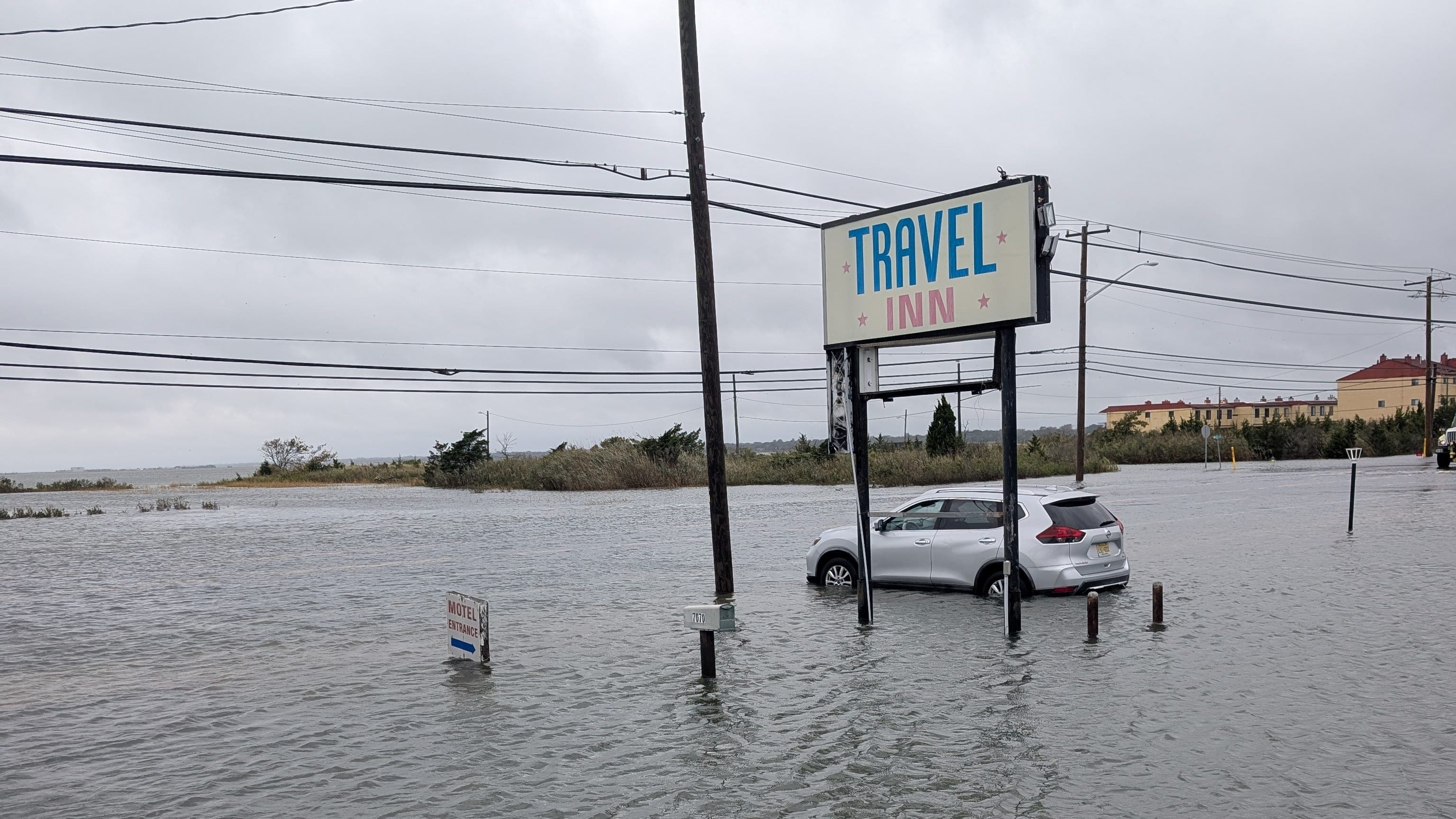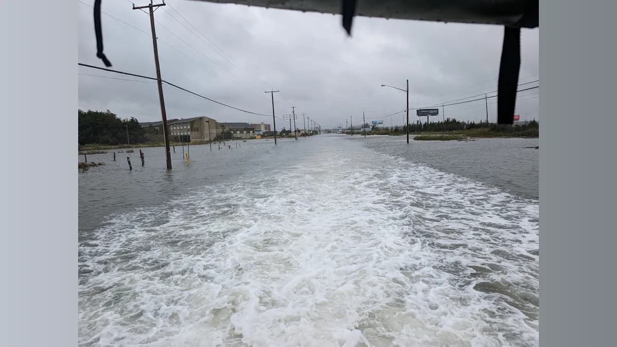
Saturday brought some of the highest water since Superstorm Sandy, motel rescues, impassable roads and widespread flooding. Sunday remains wet and windy, but forecasts show a significant improvement by Sunday evening.
ATLANTIC CITY, N.J. — After a punishing Saturday that brought major coastal flooding, damaging winds and water rescues to South Jersey, the powerful nor’easter is finally showing signs of loosening its grip on the region Sunday morning.
But the storm isn't finished yet.
Atlantic and Cape May counties remain under a Coastal Flood Warning through 2 p.m. Sunday, with another round of moderate tidal flooding expected around the morning high tide.
Rain will also continue for much of Sunday, and winds will remain gusty before gradually diminishing.
The most encouraging change came early Sunday morning when the National Weather Service canceled the High Wind Warning for coastal Atlantic and Cape May counties and replaced it with a less-severe Wind Advisory through noon.
Northwest winds of 15 to 25 mph with gusts of 40 to 50 mph remain possible.
That's a significant improvement from Saturday, when coastal gusts approached 60 mph and the persistent wind pushed huge amounts of water into South Jersey's back bays.
Saturday Flooding Reached Historic Levels
The full scope of Saturday's flooding is beginning to emerge.
A bay-side tide gauge near Margate reached major flood stage Saturday morning, climbing more than 2 feet above flood stage.
According to published reports based on gauge data, it was the third-highest crest recorded at that location and the highest since Superstorm Sandy in October 2012.
Flooding inundated streets throughout Atlantic City and Cape May County barrier-island communities, leaving numerous roads impassable.
Ocean City temporarily became inaccessible by its bridges during the worst of Saturday morning's flooding.
Sea Isle City declared a local state of emergency and ordered vehicular traffic to cease as floodwater covered streets.
Flooding also affected Avalon, Stone Harbor, the Wildwoods and Cape May.
In Atlantic County, the storm prompted a significant rescue operation in the West Atlantic City section of Egg Harbor Township.
Nine People, Dog Rescued From Flooded Motels
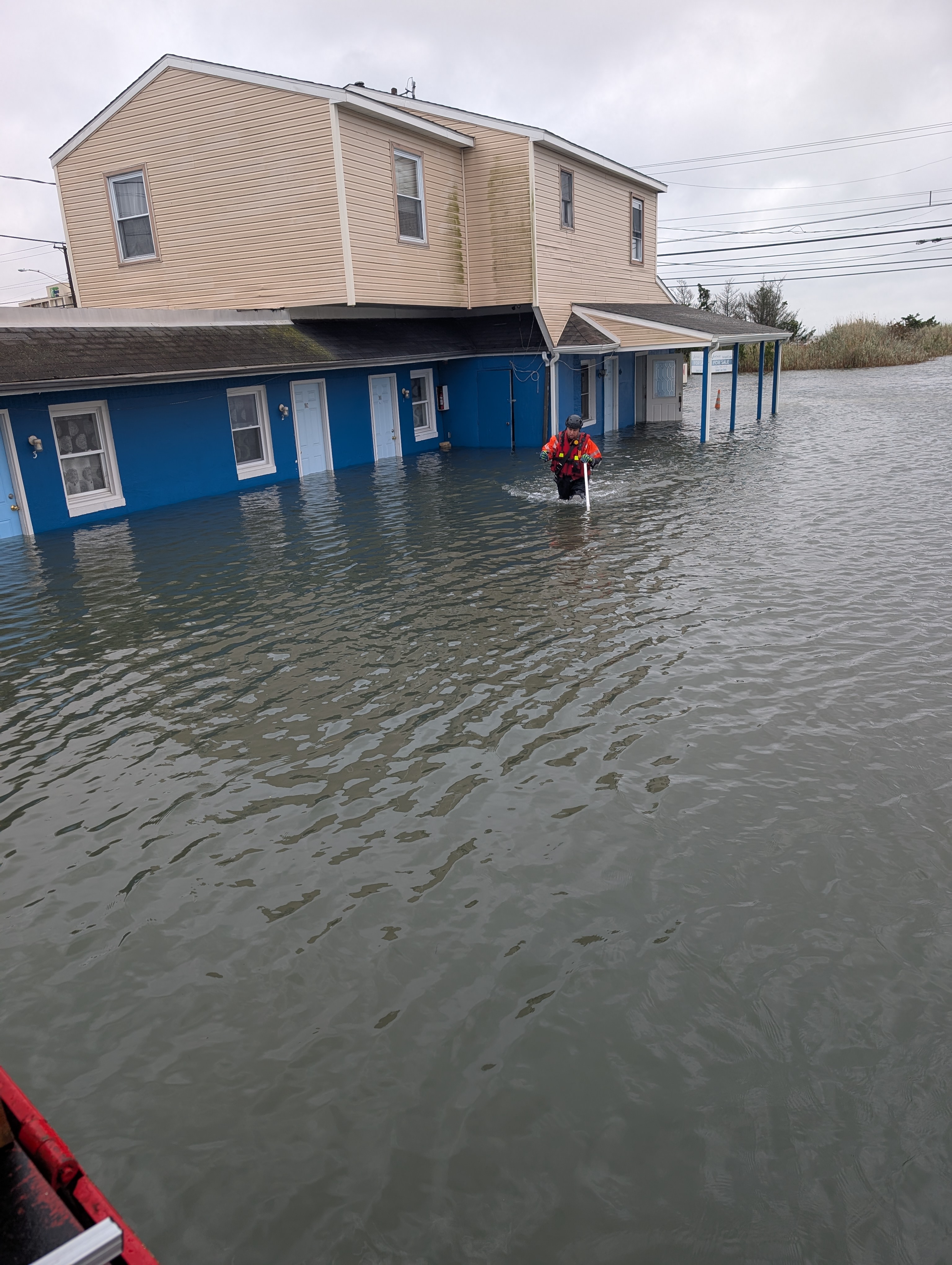
Emergency crews rescued nine adults and a dog Saturday after tidal flooding sent 2 to 3 feet of water into first-floor rooms at the Travel Inn and New Sea Breeze motels along the Black Horse Pike.
One of the adults rescued was using a wheelchair.
The Pleasantville Fire Department initially responded shortly after 9 a.m. to check on motel guests. Bargaintown Volunteer Fire Company subsequently brought in a high-water rescue vehicle and firefighters.
Those rescued were taken to the Egg Harbor Township Community Center, where they received assistance from township EMS, Public Works, Parks and Recreation and police.
During a secondary search, firefighters discovered a small fire inside one of the motel rooms at the Travel Inn and extinguished it.
No injuries were reported.
The motel flooding illustrated just how far Saturday's tidal surge extended beyond the traditional barrier-island flood zones.
One More Problematic High Tide Sunday
The National Weather Service says the coastal flooding threat continues Sunday morning.
One to 2 feet of water above ground level is possible in low-lying areas near shorelines and tidal waterways in Atlantic, Cape May and Cumberland counties.
At those levels, the Weather Service says widespread roadway flooding can occur in coastal and bayside communities, with many roads becoming impassable.
Ocean City is forecast to reach approximately 6.5 feet MLLW during Sunday morning's high tide.
That falls within moderate flood stage. Moderate flooding at the Great Egg Harbor Bay gauge begins at 6.3 feet, while major flooding begins at 7.3 feet.
Cape May Harbor is forecast around 7.3 feet MLLW Sunday morning — just into moderate flood stage there.
The good news comes with Sunday evening's tide.
Current NWS projections call for Ocean City to fall to approximately 4.9 feet Sunday evening and Cape May Harbor to about 5.9 feet — below flood stage at both locations.
If those projections hold, Sunday morning should be the final significant coastal-flooding cycle from this storm.
Rain Continues Sunday
Even as the tidal threat decreases, Sunday will remain a miserable weather day across much of South Jersey.
Periods of rain are expected throughout the day, with temperatures generally in the lower to middle 60s.
The Atlantic City area could receive another three-quarters of an inch to an inch of rain Sunday.
The storm's circulation has shifted the wind direction more toward the northwest, which is important for coastal communities.
For several days, persistent north and northeast winds had been piling ocean water into the back bays. As the storm moves and winds turn more offshore, water should finally have a better opportunity to drain.
Wind Threat Decreasing
The cancellation of the High Wind Warning is another indication that conditions are slowly improving.
The new Wind Advisory remains in effect until noon Sunday for coastal Atlantic and Cape May counties.
Northwest winds of 15 to 25 mph could still gust between 40 and 50 mph.
Those winds remain capable of bringing down weakened tree limbs and causing scattered power outages, particularly after trees and soil have been battered and saturated by the prolonged storm.
But they are below the potentially damaging 60-mph gusts included in Saturday's warnings.
Power crews were continuing restoration work across New Jersey Sunday morning. More than 10,000 JCP&L customers statewide remained without electricity around 8:15 a.m., according to the utility, after service had already been restored to more than 60,000 customers.
Those statewide figures should not be interpreted as Atlantic and Cape May County outage totals.
Beaches Remain Dangerous
Even after street flooding begins to subside, the ocean will remain extremely dangerous.
A High Surf Advisory remains in effect for the Atlantic and Cape May County coast through 8 p.m. Sunday.
Breaking waves as high as about 7 feet are possible in the surf zone, and a high risk of dangerous rip currents continues through Sunday evening.
The prolonged storm has also caused significant beach erosion along portions of the Jersey Shore.
Residents and visitors are being urged to remain away from the surf, jetties and other dangerous coastal areas.
Sunday Night Finally Brings Improvement
The nor’easter should gradually pull away from South Jersey later Sunday.
Showers could linger into Sunday evening, but winds should continue decreasing and the coastal-flooding threat is expected to drop substantially after the morning tide.
By Monday, only a chance of an early shower remains in the Atlantic City forecast, with temperatures climbing into the upper 60s and winds considerably lighter.
The long cleanup will then begin.
Communities will be assessing beach erosion, property damage, flooded vehicles and infrastructure after a storm that produced some of South Jersey's most significant tidal flooding in years.
For residents of the Shore, however, there is finally some good news in Sunday's forecast:
If current projections hold, the worst of the nor’easter is over.

About the Author
Peter Killeen
A 25-year radio news veteran, Peter covers South Jersey for NewsTalk 1400 & 92.3 WOND radio. Known for his concise and impactful delivery, he ensures listeners and readers stay informed without unnecessary filler.